The National Weather Service (NWS) has issued the following warnings for southeast Florida related to Hurricane Helene:
- Tropical Storm Warning for all South Florida through Friday morning, Sept. 27, as Tropical Storm Helene approaches.
- Tornado Watch through 8 p.m. Thursday, Sept. 26
- Flood Watch through Friday morning, Sept. 27
Possible Impacts:
- Flooding due to extensive rainfall across the region
- Damaging winds will primarily impact portions of southwest Florida although strong gusts are expected in Surfside and across the southeast as well
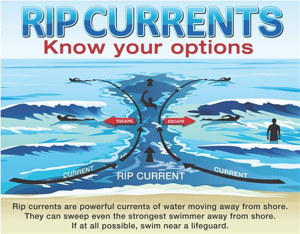
- High Rip Current Risk: Read the full statement.
More Information About Rip Current Safety:
The Rip Current Risk alert warns of dangerous rip currents expected in the ocean. Rip currents have the potential to sweep even experienced swimmers
away from the shore and into deep water.
For your safety, it is safest to avoid entering the ocean or any water activities at this time.
Always swim near a lifeguard. If caught in a rip current, do not swim against the current.
If able, swim parallel to the beach. If you are unable to escape the tide, face the shoreline and call for help.
To view the Rip Current Statement and additional updates from the National Weather Service, please refer to:
National Weather Service: Watches Warnings and Advisories.